project description
The ecological crisis of sea level rise is multifaceted, compounding, and closely tied to other threats such as saltwater intrusion, habitat
displacement, and habitat fragmentation. At-risk coastal cities are asking the question restore or retreat? as a guiding framework to address their slowly dwindling coastlines: a measure to protect both themselves and their inland rural, urban, and ecologically fragile neighbors.
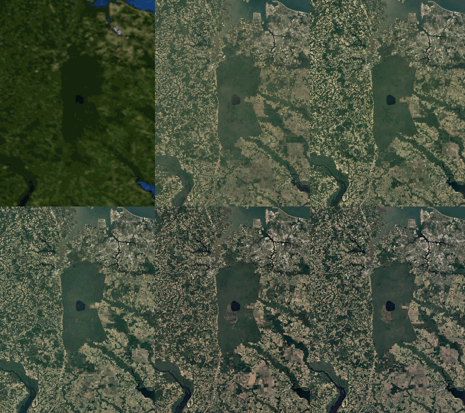
The Great Dismal Swamp (GDS) lies just to the west of Norfolk, Virginia, one of the most at-risk US cities for sea level rise, and is situated at a complex confluence of geographic, social, political, ecological, economic, and historic boundaries. The largest remaining forested swampland in the eastern US, the GDS exists across 2 states and 5 counties; is divided into a national wildlife refuge, wildlife management area, and state park; marks the boundary between the Mid-Atlantic Coastal Plain and Piedmont ecoregions; served as stop along the Underground Railroad; and was included within the territory of multiple indigenous tribes. This map series seeks to navigate these ecological crises considering the various claims that have been made to the land throughout recorded history. It's rare to
find a site that is as complicated and yet tells such a succinct story about human involvement and occupation.
Pre-colonization Native Americans lived among and with the swamp, finding it to be a source of life, legend, and wonder. The Legend of the Firebird believes that there once was a Great Firebird that built its nest in the center of the swamp and was killed by a brave Native American warrior. Upon the bird's death, the nest was set to fire and carved out present-day Lake Drummond. The blood of the bird was also said to tint the water red that evening. The first map of the series shows the overlapping tribal occupational borders within the swamp as differently hatched regions. Failed endeavors to drain the swamp and create developable land was piloted by George Washington and William Byrd in 1763 and led to centuries of similarly fruitless effort. The mystique continues through Thomas Moore’s Ballad of the Great Dismal Swamp in the early 19th century where sightings of a ghostly woman rowing her boat at night are recorded.
During the Civil War, the GDS served as a place of refuge along the Underground Railroad and many "maroons" lived and hid in the swamp for years due to its perceived impenetrability, which strengthened whispers of wildness and unknown. We know today,however, the legends and mystery of the Great Dismal can be attributed to unique ecological phenomena. The blood-red water is stained by the tannins of the surrounding cypress and juniper trees. The ghostly rower is most likely sightings of firefox, a rare bioluminescent fungus. The theme of fire seems to surround the GDS, both in legend and reality. Peat fires due to fluctuating water, extreme conditions, and lightning storms further plague the site.
location
Virginia / North Carolina border, United States
awards
Cartographic and Geographic Information Society Map Design Competition Merit Award, 2023


-----
Spatializing Extremes | Instructor: Jess Vanecek
Washington University in St. Louis